| BR-060 | |
|---|---|
 | |
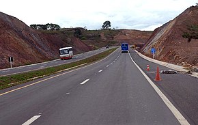
 BR-060 in Goiânia, going to Anápolis. | |
| Route information | |
| Length | 1,329.3 km (826.0 mi) |
| Major junctions | |
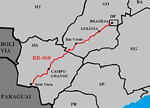
| North end | Brasília, Distrito Federal |
| South end | Bela Vista, Mato Grosso do Sul |
| Location | |
| Country | Brazil |
| Highway system | |
BR-060 is a federal highway of Brazil.[1] The 1329 kilometre road connects Brasília to Bela Vista, on the Paraguayan border.[2][3]
It is also designated as part of the Belém–Brasília Highway, in its stretch between Brasília and Anápolis.
- ^ "BR-60". Ministry of Transport. Archived from the original on 22 November 2012. Retrieved 7 June 2011.
- ^ BR 060 map
- ^ Rodovias Radiais

